What you need
- Spanner or hex key for the LNB clamp (usually 10 mm or a 4 mm hex)
- A satellite meter, or a receiver that shows signal quality as a number
- The calculated skew value for your location – from the SatFinder App or the table below
- A second person to read the meter while you turn
1What the skew actually does
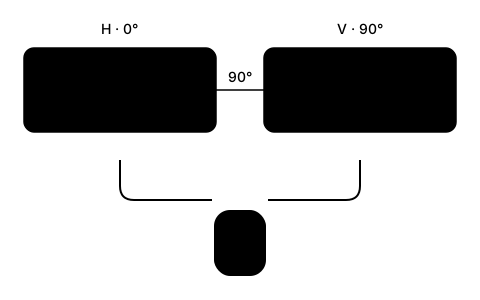
A satellite broadcasts twice as many channels as its frequency band would otherwise allow. Polarisation makes that possible: two packages of channels share the same frequency, but their waves oscillate in planes rotated 90° against each other – horizontal and vertical. On Astra 28.2° East roughly half the channels sit on H and half on V.
Inside the LNB there are two probes, likewise offset by 90°. Each one picks up exactly one plane. If the rotation of the LNB matches the rotation of the arriving waves, every probe meets its own plane cleanly. If the LNB sits askew, each probe also catches part of the other plane – that is not extra signal, it is interference.
The skew is precisely that correction: the rotation of the LNB that lines its probes up with the planes of the arriving waves.
2Why the angle depends on where you are
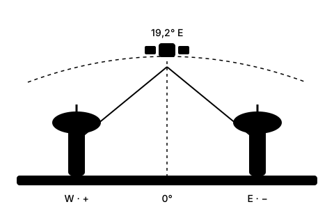
The polarisation planes are defined at the satellite relative to the equator. You, however, stand neither on the equator nor exactly on the satellite's line of longitude – and out of that double offset comes a twist that works out differently for every location.
The direction follows a simple rule: stand west of the satellite's meridian and the geometric angle is positive; stand east of it and it is negative. Directly on the satellite's longitude it is zero. For Hotbird 13° East and most other satellites that is also the value you set at the LNB.
Astra is the exception. SES transmits from Astra 19.2°, 23.5° and 28.2° East with the polarisation plane rotated by 7.5°, so that its core market, Germany, needs almost no skew: for Astra 19.2° East the zero line runs through central Germany (roughly Bremen – Kassel – Würzburg – Augsburg) rather than along the 19.2° East meridian. The SatFinder App and the table below already include those 7.5°. Even so, the British Isles need a sizeable angle for Astra 28.2° East – London, Birmingham and Dublin all sit far west of 28.2°, so they land between 13° and 15°. On Astra 19.2° East the same places would need less, about 7° to 10°, because that satellite stands closer to their own longitude.
3Finding the value for your location
The skew depends only on your coordinates and the satellite's position – not on dish size, not on LNB type and not on the receiver. So it never changes again as long as the installation stays put and points at the same satellite.
Across Great Britain and Ireland the values for Astra 28.2° East come out between about 11° and 17°, with Astra's 7.5° polarisation offset already included. The table shows azimuth, elevation and skew for a few cities. For your exact address the SatFinder App works out all three values.
| Location | Azimuth | Elevation | Skew |
|---|---|---|---|
| London | 145.4° | 25.4° | 13.2° |
| Birmingham | 143.8° | 23.8° | 13.6° |
| Manchester | 143.8° | 22.9° | 13.1° |
| Dublin | 139.5° | 21.4° | 15.3° |
4Find zero, then turn the LNB
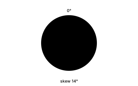
Nearly every LNB holder carries a degree scale and a zero mark. Zero means the connector points straight down and the lettering on the LNB sits level. Loosen the clamp only far enough that the LNB turns with some resistance – no further, or it will slip back on you as you tighten it.
Turn to the calculated value and tighten the clamp again. If your holder has no scale, a strip of tape around the LNB neck works as a marker: on a 40 mm neck 1° is about 0.35 mm of circumference, so 6° is a good 2 mm. That sounds like very little, but it is enough in practice because the tolerance is about ±2°.
Finally check that the cable still hangs free of tension. A taut coaxial cable will slowly turn the LNB back over the course of months.
5Fine-tune on quality, not on strength
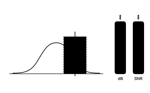
The calculated value is the starting point, not the end. Now pick one channel on the horizontal plane and one on the vertical and watch the signal quality on both.
Turn the LNB in steps of about 2° and wait two or three seconds after each step for the receiver to catch up. The correct angle is the one at which both planes together read best – not the one where either alone peaks.
Watch quality or SNR, not strength. The strength reading essentially measures how much power arrives at the input, and that barely changes as you turn. Only quality shows how cleanly the receiver can pull the data apart again.
6What usually goes wrong
On a multifeed installation with several LNBs on one bracket the skew applies to each LNB separately. Every satellite sits on a different longitude, so every LNB needs its own value – turning them all the same way is a common mistake.
A monoblock LNB for two closely spaced positions, by contrast, is one part with fixed internal geometry. Here you rotate the whole housing to the mean of the two positions; manufacturers give the right value in the data sheet.
And on offset dishes, do not confuse this with elevation. The dish stands far steeper than the elevation figure suggests, because the offset angle is subtracted from the elevation. The skew has nothing to do with that – it is always set at the LNB, never at the dish mount.
Frequently asked questions
What is LNB skew?
The skew is the angle by which the LNB is rotated in its holder so that its two receiving probes match the horizontally and vertically polarised waves from the satellite. It depends solely on your coordinates and the position of the satellite.
Which way do I turn the LNB?
If your location is west of the satellite's meridian the rotation is positive; east of it, negative. On the Astra positions (19.2°, 23.5° and 28.2° East) the satellite's 7.5° pre-rotation is subtracted on top, which makes the value smaller in the UK and moves the zero line for Astra 19.2° to central Germany. The figure is given as seen from behind, looking towards the satellite.
How many degrees of skew do I need in the UK?
For Astra 28.2° East the values across the British Isles come out around 13° to 15°: London about 13.2°, Birmingham 13.6°, Manchester 13.1°, Dublin 15.3°. That already includes the 7.5° by which Astra pre-rotates its polarisation. For your exact address the SatFinder App calculates the value.
Why do other skew calculators show 7.5° more for Astra?
Many calculators only use the geometric formula and leave out Astra's pre-rotation. SES transmits from 19.2°, 23.5° and 28.2° East with the polarisation plane rotated by 7.5°, so that Germany needs almost no skew. Without that correction a calculator shows about 20.7° for London on Astra 28.2° East instead of 13.2°. The SatFinder App includes the 7.5°; for Hotbird 13° East and other satellites without an offset the geometric value applies.
What happens if the skew is set wrong?
Signal strength stays roughly the same, signal quality falls. In fair weather you will not notice; in rain or snow the channels on one polarisation plane drop out first. Beyond about 10° of error the loss becomes measurable even under a clear sky.
Is the skew different on a twin or quad LNB?
No. Twin, quad and octo differ only in the number of outputs, not in internal geometry. The skew is the same for all of them. Multifeed with several separate LNBs is the exception – there each LNB needs its own value.
Is there a skew table to look up?
The table in step 3 shows azimuth, elevation and skew for several cities. Because the value moves steadily with longitude you can interpolate between two of them – or have it calculated for your coordinates directly, which is more accurate than any table.