What you need
- A compass, or a smartphone with a compass app
- The calculated azimuth for your location, both true and magnetic
- A straight rod and a sunny moment, if you want to calibrate against the sun
- A tape measure, to keep your distance from the mast
1True north is not magnetic north
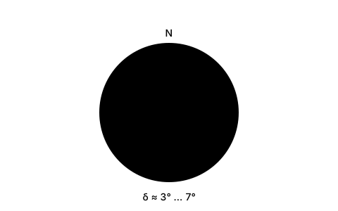
Calculated satellite angles always refer to the geographic north pole — the point the earth turns around. A compass, by contrast, points at the magnetic north pole, and that lies elsewhere. The difference between the two directions is called declination.
It is not a measurement error but a known quantity: for any point on earth it can be computed from the World Magnetic Model, a model reissued every five years. It changes slowly — the magnetic north pole is currently drifting about 35 kilometres a year towards Siberia.
In practice this means: when someone gives you an azimuth figure, you have to know which one is meant. A true value read off a compass produces a dish pointing wrong by the amount of the declination.
2How big the error is where you are
In central Europe the declination is currently around three to six degrees east. That sounds harmless, but on an 80 cm dish it is already more than the entire usable window: you would simply miss the satellite even though the compass reads exactly what you calculated.
The value moves with longitude. In western France it is smaller, in Ukraine and the Baltics considerably larger. And it moves with time: a figure from a ten-year-old book is already a degree out today.
The table shows the true azimuth values for a few cities — declination still has to be applied on top. The SatFinder App gives both values separately and takes the declination for your coordinates straight from the World Magnetic Model, so you do not have to look it up.
| Location | Azimuth | Elevation | Skew |
|---|---|---|---|
| London | 145.4° | 25.4° | 13.2° |
| Birmingham | 143.8° | 23.8° | 13.6° |
| Manchester | 143.8° | 22.9° | 13.1° |
| Dublin | 139.5° | 21.4° | 15.3° |
3Metal at the mast: the largest single error
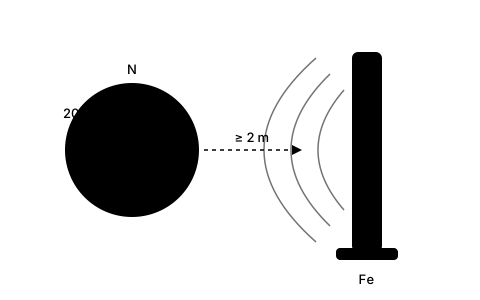
Declination is calculable and therefore manageable. The real problem when aligning is something else: the steel you are standing next to. A compass measures the magnetic field where it is — and a mast tube, a wall bracket or a roof rail distorts that field considerably.
Right at the mast, deviations of twenty degrees and more are not unusual. That is four to six times the declination, and it cannot be calculated, because it depends on the amount and position of the metal. The phone itself can interfere too: a magnetic case, a ring holder or a charging pad nearby will skew the reading.
So keep at least two metres from any sizeable mass of metal and take the bearing before you mount the dish. A simple test: turn slowly through a full circle and watch the display. If it runs smoothly through, all is well; if it jumps or sticks, there is iron nearby.
4The sensor in the phone: how it works and when it lies
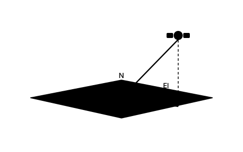
A smartphone has no compass needle but a magnetometer on a chip. It measures the earth's field along three axes and, together with the orientation sensor, computes a heading from that. It works well — as long as the sensor is calibrated.
Calibration is lost through everyday movement, especially if the phone has lain on a magnet for a while. That is why operating systems occasionally ask for the figure-of-eight motion: it lets the sensor gather readings in different orientations and recompute its zero points.
Practically: do the figure-of-eight before you take a bearing, hold the phone level, and only read once the display has been steady for two or three seconds. A twitching display is not a reading, it is a warning.
5Calibrating against the sun
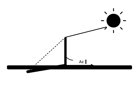
The way out of the whole magnetic problem is old and surprisingly accurate: the sun. Its position in the sky can be calculated exactly for any place and moment — and geographically, with no reference to the earth's magnetic field at all.
In practice it works like this: stand a straight rod upright, or use a mast, a fence post, anything plumb. The shadow points exactly away from the sun. If you know the calculated solar azimuth for that moment, you also know true north — to a tenth of a degree, independent of any declination and any steel beam.
The SatFinder App brings this calibration with it: it computes the solar azimuth for your coordinates and the current time and lets you align the compass heading to it. After that the app shows the direction to the satellite without the magnetometer playing any part at all.
6The practical route at the mast
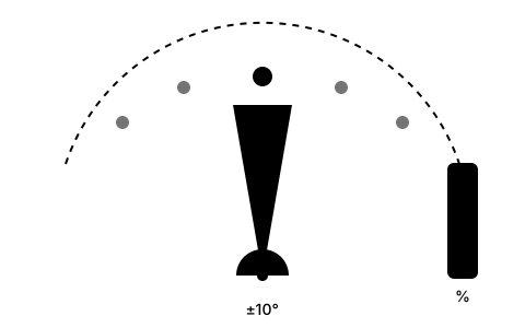
Put it all together before you go up. Take the magnetic azimuth, not the true one. Sight from at least two metres away from the mast and mark the direction on the ground. If the sun is out, calibrate against it first — that replaces both of the previous points.
Then align roughly to the mark and sweep slowly, about one degree every two seconds. The compass has brought you into a window of a few degrees; from here the signal display takes over, because no compass in the world gets you to a tenth of a degree.
And if you find nothing at all: the compass is rarely to blame. More often it is the elevation, frequently the forgotten offset angle of the dish, or an obstacle in the line of sight. Check those two before you keep hunting on azimuth.
Frequently asked questions
What is magnetic declination?
The angle between true north — the earth's axis of rotation — and magnetic north, where a compass points. In central Europe it is currently about three to six degrees east. Calculated satellite angles are true; a compass reads magnetic, so you must convert or use a tool that gives both values.
How much declination is there where I live?
That depends on your coordinates and changes slowly over the years. In Germany the value is currently around three to five and a half degrees east, more in eastern Europe, less in western France. The SatFinder App takes the declination from the World Magnetic Model for your position and shows true and magnetic azimuth separately.
Why does my phone compass read completely differently at the mast?
Because the steel of the mast distorts the magnetic field. Right at the mast, deviations of twenty degrees and more are possible — several times the declination. Sight from at least two metres away and mark the direction on the ground before you mount the dish.
How do I calibrate the compass in my phone?
Do the figure-of-eight motion the operating system occasionally asks for: it lets the magnetometer gather readings in different orientations and reset its zero points. Then hold the device level and only read once the display has been steady for a few seconds.
What does calibrating against the sun achieve?
It bypasses the magnetic field entirely. The sun's position can be computed geographically and exactly for any place and time, so the shadow of a vertical rod gives you a north direction affected neither by declination nor by steel nearby. It works best in the morning or late afternoon, when the shadow is long.
Is a compass enough for alignment at all?
For coarse alignment yes, for fine-tuning no. A compass brings you into a window of a few degrees — enough for the receiver to show a signal. The last tenths of a degree you get from signal quality, not from a compass bearing.