What you need
- A smartphone with compass, tilt sensor and camera — every device of the last ten years has them
- The SatFinder App in the browser, for azimuth, elevation and skew at your location
- A spanner for the mast and elevation bolts
- A second person at the television reading out the signal display — or a phone call on speaker
1What the phone can do — and what it cannot
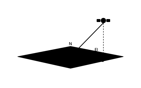
Honestly, up front: a smartphone does not replace a meter, it replaces guessing. A phone compass is typically accurate to two to five degrees, the tilt sensor to about one degree. An 80 cm dish has a half-power beamwidth of roughly two degrees — so the phone reliably gets you into the window where the receiver can show a signal at all.
What the phone has over the meter is sight. A satellite meter tells you how strong a signal is, but not why none is arriving. The AR camera, by contrast, shows you before installation whether there is a clear view to the satellite at all — and that is the question most self-installations fail on, long before any angle was wrong.
So the division of labour is clear: the phone handles location, line of sight and coarse alignment; the receiver's signal display handles the last tenths of a degree.
2Calculate the angles for your location
Before you touch anything you need three numbers: azimuth, the compass direction; elevation, the angle above the horizon; and skew, the rotation of the LNB. They depend only on your coordinates and the chosen satellite.
The distinction between true and magnetic azimuth matters. Calculated values are true; your phone compass reads magnetic. In central Europe the difference is currently around three to six degrees — more than the entire usable window of a dish with two degrees of beamwidth. The SatFinder App gives both values separately so you do not have to convert.
The table shows the range the values fall in. For your exact address the app works them out as soon as you allow location access or type an address.
| Location | Azimuth | Elevation | Skew |
|---|---|---|---|
| London | 145.4° | 25.4° | 13.2° |
| Birmingham | 143.8° | 23.8° | 13.6° |
| Manchester | 143.8° | 22.9° | 13.1° |
| Dublin | 139.5° | 21.4° | 15.3° |
3Check the line of sight with the AR camera
This is the step a meter cannot do, and the one that saves you a whole day of installation if it goes badly. Hold the phone where the dish is meant to go and open the AR view. It lays the calculated satellite position and the arc of the geostationary belt over the camera image.
Now you see immediately what stands between you and the satellite: the neighbour's gable, the spruce, the balcony above. In central Europe a satellite sits only about 30 degrees above the horizon — flatter than most people expect, which is why one tree forty metres away is enough.
Check too whether an obstacle only just misses. A branch two degrees clear of the line of sight today sits right in it in three years — and rain in the foliage attenuates well before that.
4Set elevation with the tilt sensor
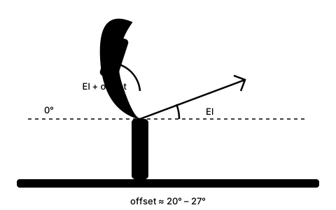
For elevation you do not need the compass at all, only the tilt sensor — and that is accurate enough. Lay the phone flat against the back of the reflector or against the mount, depending on what your dish's degree scale refers to.
Here lurks the mistake that costs most self-installations: on an offset dish the reflector stands far steeper than the elevation figure suggests. The offset angle of the reflector — 20 to 27 degrees depending on the model — is subtracted from the elevation. At 30 degrees of elevation and 24 degrees of offset the reflector therefore leans back only about 6 degrees from the vertical: it stands almost upright.
The way out is simple: use the degree scale on the mount, because the manufacturer has already referenced it to elevation. Only if you lay the phone directly against the reflector do you have to subtract the offset angle from the data sheet yourself.
5Azimuth with the compass — and sweep slowly
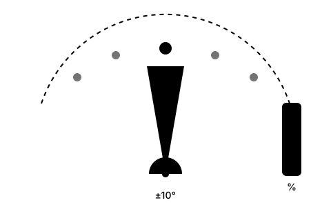
Now the compass. Stand behind the dish, look towards the satellite and set the mast roughly to the magnetic azimuth. Keep your distance from metal, and turn once slowly on the spot before reading: if the display jumps as you turn, there is an interfering field nearby.
Once the rough direction is set, loosen the mast clamp only enough that the dish turns with effort. Then sweep slowly — about one degree every two seconds. The receiver needs that time to lock and display a signal it has found. Sweep fast and you pass the satellite without the display ever reacting.
If you find nothing within a ten-degree sweep either side of the calculated value, stop turning. Then it is more likely the elevation that is wrong, or you are on the wrong satellite — searching further only makes it worse.
6Fine-tuning without a meter
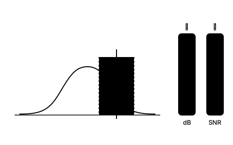
For the last tenths of a degree you need feedback, and your receiver's signal display provides it. It sits in the installation or antenna menu and shows two values: strength and quality. For fine-tuning only quality counts — strength barely changes as you turn.
The problem is the distance between mast and television. The classic solution is a second person reading out. A phone call on speaker works almost as well, or place the television so you can see it through a window. Some receivers additionally emit a tone whose pitch rises with quality — for this job that is the best thing there is.
Optimise in the order elevation, azimuth, skew, and tighten the bolts hand-tight after each step before touching the next value. Finally tighten everything properly and read the values once more: while being tightened a dish likes to shift by exactly the degree you just worked out.
Frequently asked questions
Can you align a satellite dish without a meter?
Yes. For coarse alignment a smartphone is enough: compass for azimuth, tilt sensor for elevation, camera for the line of sight. The final fine-tuning you do on the signal quality shown by your receiver. A meter is more convenient but not necessary.
How accurate is a phone compass?
Typically two to five degrees. That is enough to reach the window in which the receiver shows a signal — an 80 cm dish has about two degrees of beamwidth. What matters is distance from metal: at a steel mast, twenty degrees of deviation is possible.
Why does my offset dish stand far steeper than the calculated elevation?
Because the reflector's offset angle is subtracted from the elevation, 20 to 27 degrees depending on the model. At 30 degrees of elevation and 24 degrees of offset the reflector therefore leans back only about 6 degrees from the vertical. The degree scale on the mount already refers to elevation — only if you measure directly on the reflector do you have to subtract the offset yourself.
Why use the AR camera if I already have the angles?
Because the angles say nothing about whether the path is clear. The AR view lays the satellite position over the camera image and shows you, before installation, whether a tree, a gable or a balcony sits in the line of sight. A meter cannot do that — it only reports that no signal is arriving.
Should I use the magnetic or the true azimuth?
On a phone compass, the magnetic one. Calculated values are true; the difference in central Europe is currently around three to six degrees and thus larger than the dish's beamwidth. The SatFinder App shows both values separately.
Why do I find no signal even though the compass is right?
Usually the elevation is wrong — often because of the offset angle. The second most common cause is an obstacle in the line of sight, the third is sweeping too fast: the receiver needs one to two seconds to display a signal it has found.